What is GIS?
ArcGIS is an ESRI program which allows users the ability to compile pertinent data to a specific geographic region in an interactive layout or map. The ESRI website includes a tutorial which orients the layperson with the software well enough to the point of being able to generate a map with useful data.
What Can You Do with GIS?
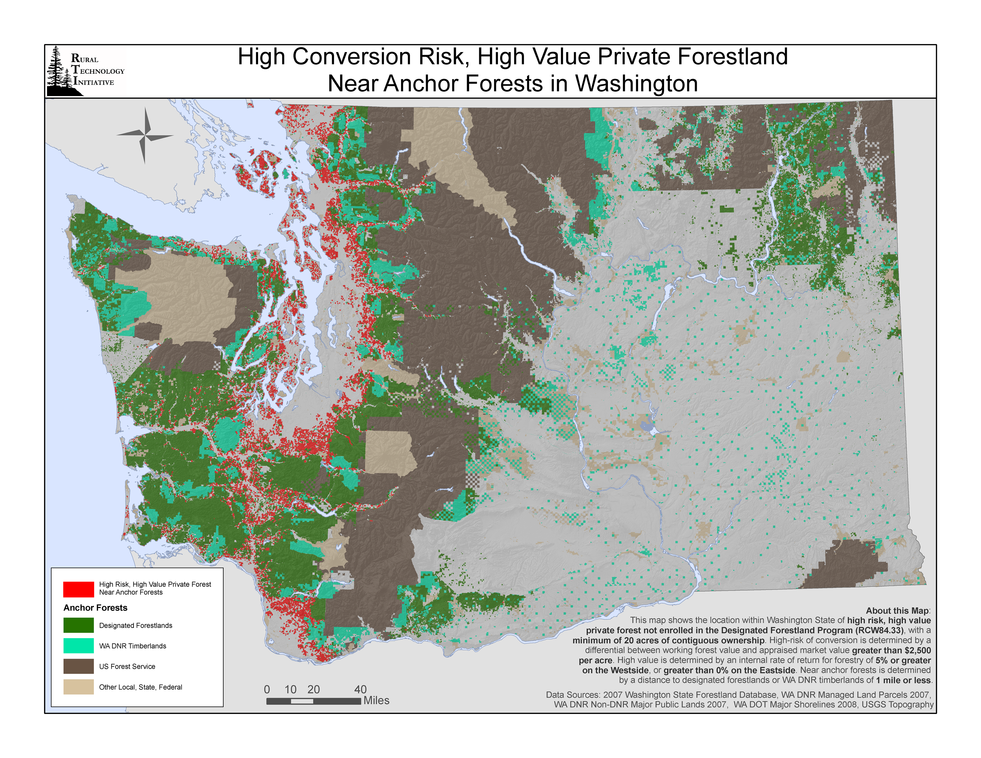
As an example, Washington State University used GIS to demonstrate the retention of high-valued forest lands at risk of conversion to non-forest uses in Washington State.

The map displays an easily read representation of Washington State using ArcGIS software. In the legend, the endangered lands are clearly indicated by colors which carry distinct connotations, specifically red to indicate "High Risk, High Value Private Forest Near Anchor Forests."
